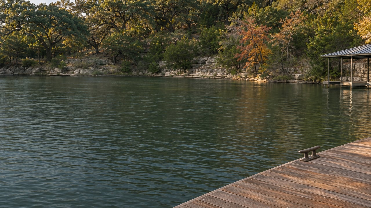
Two Lake Austin waterfront homes can list in the same price band and look the same from the dock on a clear December afternoon. Come July, one has open water off the boat lift. The other has a green mat reaching the surface, and the boat needs a cut channel to get out. The City of Austin's own survey work this fall shows which stretches of the lake are which. A buyer touring this winter sees the lake in its most forgiving season.
The lake divides into reaches
Austin Watershed Protection calls Lake Austin "relatively small and narrow." It is a pass-through reservoir held at a constant level between Lake Travis and Lady Bird Lake. Because the water level never moves, buyers tend to treat the whole lake as one uniform amenity. The vegetation surveys say it isn't.
In September 2026, Texas Parks and Wildlife surveyed the lake and counted 575 acres of hydrilla and 99 acres of Eurasian watermilfoil. Hydrilla coverage had held steady since the June survey, but it had moved. The City's summary of that survey reads like a map of the shoreline.
The upper lake is where hydrilla dominates. A modest floodgate release from Mansfield Dam in July "did not significantly reduce coverage." The middle reach, from Commons Ford Park to Emma Long Metropolitan Park, "generally has much less hydrilla," with patches of milfoil along parts of the banks. Downstream, hydrilla increased slightly along the shoreline approaching Ski Shores Marina. Bull Creek "was nearly completely covered," and boats got through on a cut channel. In Bee Creek Cove near Tom Miller Dam, hydrilla reached the surface across the whole cove and covered more area than it had a year earlier.
A City memo dated Oct. 22, 2026 names the same places. Most of the hydrilla had settled further below the surface, which eased some of the conflict with boating. The memo still lists "focal points of topped out dense growth that are causing navigational problems," with Bull Creek, Bee Creek and the shoreline near the basin and upper lake as the notable areas.
The lake-wide acreage matters less to a buyer than where that acreage sits. A lot on the open middle reach and a lot inside Bull Creek or Bee Creek Cove are on the same lake but have very different water off the dock.
A December showing sees the quiet version
That memo's line about growth sitting "further below the water surface" describes the lake in the season when most winter buyers will see it. The summer looks different. The City says hydrilla spread "even more rapid[ly]" in the summer of 2025, and it points to warm water, low flows and nutrients carried in after the July floods.
News reports describe what that summer looked like on the water. In October 2025, KXAN described thick patches downstream near Tom Miller Dam and boat docks "seemingly surrounded by an undersea jungle." In May 2026, Dr. Brent Bellinger of Austin Watershed Protection told News4 San Antonio that boats moving closer to shore risk "entanglement or your motor's getting fouled up." This fall, KVUE reported that boats were picking hydrilla up on their propellers, which can make steering difficult in the narrow waterway with other boats passing.
In every one of those accounts, the trouble shows up near shore and in tight water. Coves and creek mouths are also where docks, swim ladders and boat lifts sit, and that shoreline water is what a winter tour sees at its calmest.
The cove stays the question for more than one season
The City's own plans measure the fix in years. The main tool is sterile grass carp, which prefer hydrilla to other plants. Austin Watershed Protection built a predictive model on 15 years of Lake Austin data. It indicated that roughly 7,000 carp added in fall 2026 would start hydrilla on a path downward. The City released 7,091 in October 2026. KXAN reported that the fish went in near Jessica Hollis Park, the Walsh Boat Ramp and Bull Creek, which the department called the areas of heaviest growth. Including that release, the stocking record since July 2025 runs as follows.
| Timeframe | Grass carp added |
|---|---|
| July 2025 | 358 |
| November 2025 | 1,995 |
| May 2026 | 2,790 |
| October 2026 | 7,091 |
The City is open about the timing. It does not "expect to see immediate reductions" after a stocking, and its model shows "a wide variation" in how long the lake may take to get back to its target of 10 to 30 percent vegetation coverage, because weather and flows are out of its control. The last time the lake swung hard, it took about 10 years to settle back to target levels.
The other tool a waterfront owner tends to count on is a drawdown. The City canceled the fall 2026 drawdown, which had been set for Oct. 12 through Nov. 30, and has set no new date. The Muny deadline post covers that decision. The stakeholder minutes add one detail a buyer should hear. The City says LCRA "continues to reinforce that a January/February timeframe is not an option" because of winter power generation. The City also notes that hydrilla roots survive a drawdown and the plant "may bounce back within a short time."
Put together, a buyer this winter has no scheduled low-water window and is relying on a carp program the City describes in years. The cove a house sits on is likely to look next summer much as it did this past one.
What owners do at the dock now
For shoreline homeowners, the City names mechanical removal as the method for "temporary, localized relief." It also calls lake-wide removal impractical because hydrilla grows fast and regrows from small fragments. Owners with hydrilla near their property can hire a contractor to clear around docks. Local outfits such as Captain Home Services and Hydrilla Killas advertise manual clearing on Lake Austin. Hydrilla Killas also lists bottom-barrier installation and both one-time and recurring cleanups, and it says hydrilla can come back within weeks.
The City is also working on a bottom-barrier policy with Austin Development Services, according to the Oct. 22 memo. The same memo says the City will publish a Lake Austin Vegetation Management Plan by the end of the calendar year. The stakeholder group has also agreed to add members, especially from commercial interests and the Bull Creek area.
The City adds one note aimed at the shoreline itself. Lawn and garden fertilizer can wash into the lake and feed hydrilla, and a buffer of native and adapted plants along the water helps hold it back. The landscaping between the house and the bulkhead affects the water in front of it, which matters to anyone weighing a renovation or new build on a Lake Austin lot.
Chris Krueger has spent more than two decades in homebuilding and real estate, and he reads a waterfront listing that way. The structure is half the picture. The other half is how often the water in front of it needs work, and who has been doing that work. A seller who has cleared around the dock every summer has a record. Ask whether the clearing was one-time or recurring, who did it, and whether any bottom barrier is in place. The Lake Austin dock post covers the paperwork side of a waterfront file.
A few direct questions
Is the middle of the lake clear of hydrilla? The September 2026 survey found the stretch from Commons Ford Park to Emma Long Metropolitan Park had much less hydrilla than other parts of the lake, with some milfoil patches along the banks. Less is not none, and conditions shift between surveys.
Will the October carp release show results by next summer? The City does not expect immediate reductions after a stocking. It plans to compare each new survey against its model and adjust from there.
Where can I check conditions myself? Austin Watershed Protection posts survey summaries and stakeholder meeting notes on its Lake Austin page, and LCRA's Hydromet shows real-time lake conditions.
If a Lake Austin home is on your list this winter, Chris Krueger Real Estate can help you look at the cove, the dock and the shoreline record along with the house, and estimate what next summer will ask of that stretch of water before you commit. Our Lake Austin neighborhood page is a good place to start, and when you're ready to tour, let's work together.